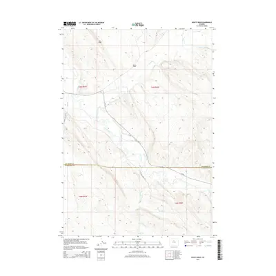
2015 Map of Weintz Draw
USGS Topo · Published 2015About this map
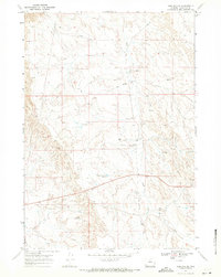
The Nowood River and Paint Rock Cr converge in this high-desert landscape, creating a complex network of natural waterways and managed irrigation. The map reveals the heavy reliance on water management in the Big Horn Basin through features like the Ninety-six Canal, Anita Ditch, and several dispersed livestock or irrigation catchments including Brewster Reservoir and H G Reservoir. The terrain is defined by prominent uplifts such as Blue Ridge and the elongated Bentonite Ridge, which runs parallel to the river valley. Transportation in this area is a mix of county routes and industrial access, notably the Bonanza Oil Field Rd, reflecting the region's energy and ranching history. The boundary between Big Horn Co and Washakie Co bisects the southern portion of the quadrangle, cutting through the drainage of Big Cottonwood Cr.
Find a feature on this map
23 named features on this map. Tap any name to fly to it.
Don’t see what you’re looking for? This feature index may not catch every label — zoom into the map to look around manually.
Map Details
Editions of this 2015 Weintz Draw Map
This is the sole edition of this map. No revisions or reprints were ever made.
Other maps of this area

1955 · Sheridan
USGS Topo · 1:250,000

1958 · Sheridan
USGS Topo · 1:250,000

1960 · Flitner Reservoir
USGS Topo · 1:24,000

1960 · Hyatt Ranch
USGS Topo · 1:24,000

1960 · Manderson SE
USGS Topo · 1:24,000

1962 · Sheridan
USGS Topo · 1:250,000
1967 · Hyattville
USGS Topo · 1:24,000
1967 · Weintz Draw
USGS Topo · 1:24,000
1967 · Broom Draw
USGS Topo · 1:24,000
1967 · Worland SE
USGS Topo · 1:24,000