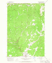
1966 Map of Weippe North
USGS Topo · Published 1968About this map
Weippe Prairie dominates the southern landscape of this mid-1960s survey, marking a transition from the agricultural plateaus to the timber-rich drainages of the Clearwater National Forest. The settlement of Weippe serves as a hub for the local timber industry, as evidenced by several named processing sites including Battles Mill, Johnsons Mill, and McGann Mill scattered throughout the valleys. To the north, the terrain drops sharply toward Orofino Creek and its many tributaries like Cow Creek and Haley Creek. The geography here reflects a working forest economy, with a network of unimproved roads and a Jeep Trail leading to landmarks such as Orofino Creek Point. Local life is further evidenced by the High Sch and Rodeo Grounds in the south, while the northern edge touches upon the higher elevations of the Camas Prairie.
Find a feature on this map
39 named features on this map. Tap any name to fly to it.
Don’t see what you’re looking for? This feature index may not catch every label — zoom into the map to look around manually.
Map Details
Editions of this 1966 Weippe North Map
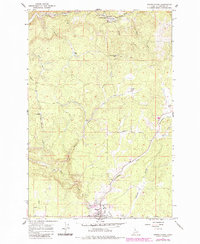
2 editions found
Other maps of this area

1923 · Washington Creek
USGS Topo · 1:125,000

1924 · Kamiah
USGS Topo · 1:125,000

1924 · Weippe
USGS Topo · 1:125,000

1938 · Headquarters
USGS Topo · 1:48,000

1944 · Headquarters
USGS Topo · 1:62,500

1955 · Pullman
USGS Topo · 1:250,000

1956 · Hamilton
USGS Topo · 1:250,000

1958 · Pullman
USGS Topo · 1:250,000

1959 · Hamilton
USGS Topo · 1:250,000

1960 · Hamilton
USGS Topo · 1:250,000