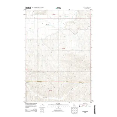
2013 Map of Weiser Cove
USGS Topo · Published 2013About this map
Weiser River irrigation and the rugged transition from valley floor to desert hills define this 2013 survey of the borderlands between Washington and Payette Counties. The northern agricultural basin is dominated by the complex water management of the Galloway Canal and Sunnyside Canal, which feed the small settlements of Rebecca and Weiser Cove. These engineering works transformed the arid landscape near Mann Cr and Cove Cr into a productive rural corridor.
Find a feature on this map
23 named features on this map. Tap any name to fly to it.
Don’t see what you’re looking for? This feature index may not catch every label — zoom into the map to look around manually.
Map Details
Editions of this 2013 Weiser Cove Map
This is the sole edition of this map. No revisions or reprints were ever made.
Other maps of this area

1897 · Weiser
USGS Topo · 1:125,000

1951 · Payette
USGS Topo · 1:24,000

1951 · Weiser South
USGS Topo · 1:24,000

1952 · Weiser Cove
USGS Topo · 1:24,000

1952 · Birding Island
USGS Topo · 1:24,000

1953 · Mann Creek
USGS Topo · 1:62,500

1955 · Baker
USGS Topo · 1:250,000

1957 · Crane Creek Reservoir
USGS Topo · 1:62,500

1959 · Baker
USGS Topo · 1:250,000
1970 · Sheep Ridge
USGS Topo · 1:24,000