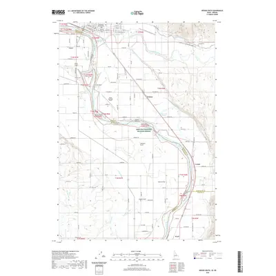
2020 Map of Weiser South
USGS Topo · Published 2020About this map
The Snake River defines the border between Idaho and Oregon, winding through a landscape shaped by an extensive network of irrigation canals and ditches. This 2020 survey captures the agricultural heart of the region, where the Galloway Canal, Lower Payette Ditch, and Owyhee Canal support farms surrounding the southern outskirts of Weiser. The map identifies several river features, including Patch Island, Smith Island, and Larson Island, alongside significant protected land within the Deer Flat National Wildlife Refuge.
Find a feature on this map
135 named features on this map. Tap any name to fly to it.
Don’t see what you’re looking for? This feature index may not catch every label — zoom into the map to look around manually.
Map Details
Editions of this 2020 Weiser South Map
This is the sole edition of this map. No revisions or reprints were ever made.
Other maps of this area

1897 · Weiser
USGS Topo · 1:125,000

1951 · Moores Hollow
USGS Topo · 1:24,000

1951 · Malheur Butte
USGS Topo · 1:24,000

1951 · Moores Hollow
USGS Topo · 1:62,500

1951 · Payette
USGS Topo · 1:24,000

1951 · Weiser South
USGS Topo · 1:24,000

1952 · Weiser Cove
USGS Topo · 1:24,000

1952 · Birding Island
USGS Topo · 1:24,000

1952 · Olds Ferry
USGS Topo · 1:62,500

1952 · Olds Ferry SE
USGS Topo · 1:24,000