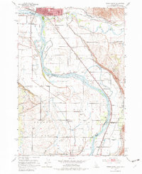
1951 Map of Weiser South
USGS Topo · Published 1982About this map
The Snake River dominates this borderland landscape in the early 1950s, defining the boundary between Washington County, Idaho, and Malheur County, Oregon. The city of Weiser serves as a hub of activity at the northern edge, supported by the Union Pacific and Oregon Short Line railroads. The map reveals an intensive irrigation network essential to the region's agriculture, featuring the Galloway Canal, Sunnyside Canal, and several major ditches like the Lansing Ditch. Numerous islands such as Patch Island and Long Island split the river's path, while the presence of several schools marked as abandoned, including Park Sch and Crystal Sch, suggests a shift in the local rural population. Gathering places like the Oregon Slope Community Hall and Hyline Hall indicate the social centers for the farming communities scattered along the river's fertile banks.
Find a feature on this map
60 named features on this map. Tap any name to fly to it.
Don’t see what you’re looking for? This feature index may not catch every label — zoom into the map to look around manually.
Map Details
Editions of this 1951 Weiser South Map
2 editions found
Other maps of this area

1897 · Weiser
USGS Topo · 1:125,000

1951 · Moores Hollow
USGS Topo · 1:24,000

1951 · Malheur Butte
USGS Topo · 1:24,000

1951 · Moores Hollow
USGS Topo · 1:62,500

1951 · Payette
USGS Topo · 1:24,000

1951 · Weiser South
USGS Topo · 1:24,000

1952 · Weiser Cove
USGS Topo · 1:24,000

1952 · Birding Island
USGS Topo · 1:24,000

1952 · Olds Ferry
USGS Topo · 1:62,500

1952 · Olds Ferry SE
USGS Topo · 1:24,000