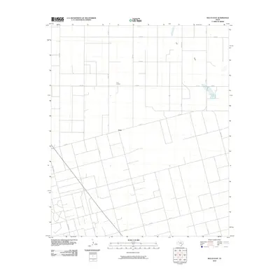
2010 Map of Welch East
USGS Topo · Published 2010About this map
Pride is the central point of interest in this Dawson County landscape, where the town site and the nearby Pride Cemetery reflect the long-standing agricultural community. The terrain is defined by the ephemeral Lost Draw, which meanders across the northern portion of the quadrangle toward Frost Lake in the northeast. This 2010 survey illustrates a highly structured grid of section roads, including Farm Rd 179 and Ranch Rd 829, which facilitate the region's transport and land management. The sparse distribution of named settlements emphasizes the rural character of the area, where water features like Frost Lake serve as key markers in an otherwise uniform landscape of fields and range land.
Find a feature on this map
23 named features on this map. Tap any name to fly to it.
Don’t see what you’re looking for? This feature index may not catch every label — zoom into the map to look around manually.
Map Details
Editions of this 2010 Welch East Map
This is the sole edition of this map. No revisions or reprints were ever made.
Other maps of this area

1954 · Lubbock
USGS Topo · 1:250,000

1954 · Hobbs
USGS Topo · 1:250,000

1954 · Big Spring
USGS Topo · 1:250,000

1954 · Brownfield
USGS Topo · 1:250,000

1958 · Brownfield
USGS Topo · 1:250,000

1958 · Big Spring
USGS Topo · 1:250,000

1958 · Hobbs
USGS Topo · 1:250,000

1962 · Brownfield
USGS Topo · 1:250,000

1968 · Lamesa North
USGS Topo · 1:24,000

1969 · Welch East
USGS Topo · 1:24,000