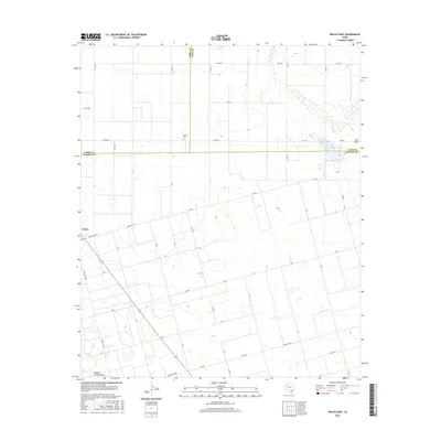
2016 Map of Welch East
USGS Topo · Published 2016About this map
Pride Cem serves as a quiet landmark at the intersection of Terry, Lynn, and Dawson counties in this high plains landscape. The map highlights the localized topography of the Llano Estacado, where drainage patterns like Lost Draw and Sulphur Springs Draw carve subtle relief into the surrounding agricultural grid. These ephemeral watercourses, along with Frost Lake, illustrate the unique hydrology of the Texas Panhandle region, where seasonal catchment areas are as vital as the established road network. The small settlement of Welch sits along the western edge, connected to the wider region by a web of rural routes including FM 179 and Ranch Rd 1066. This survey provides a clear view of the intersection of three Texas counties, documenting the placement of property lines and rural infrastructure in an area defined by its vast stretches of farmland and natural depressions.
Find a feature on this map
31 named features on this map. Tap any name to fly to it.
Don’t see what you’re looking for? This feature index may not catch every label — zoom into the map to look around manually.
Map Details
Editions of this 2016 Welch East Map
This is the sole edition of this map. No revisions or reprints were ever made.
Other maps of this area

1954 · Lubbock
USGS Topo · 1:250,000

1954 · Hobbs
USGS Topo · 1:250,000

1954 · Big Spring
USGS Topo · 1:250,000

1954 · Brownfield
USGS Topo · 1:250,000

1958 · Brownfield
USGS Topo · 1:250,000

1958 · Big Spring
USGS Topo · 1:250,000

1958 · Hobbs
USGS Topo · 1:250,000

1962 · Brownfield
USGS Topo · 1:250,000

1968 · Lamesa North
USGS Topo · 1:24,000

1969 · Welch East
USGS Topo · 1:24,000