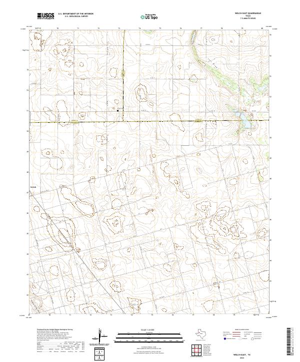
2022 Map of Welch East
USGS Topo · Published 2022About this map
The West Texas high plains of Dawson, Terry, and Lynn Counties intersect on this sheet, defined by a distinct network of section-line roads and seasonal drainage patterns. The community of Welch sits on the western edge, serving as a hub for the surrounding ranching and agricultural land. The landscape is marked by the presence of Frost Lake, a significant local basin that captures runoff from the ephemeral Lost Draw to the north. In the southern reaches of the quadrangle, Sulphur Springs Draw cuts through the terrain, illustrating the gradual topographic shifts characteristic of the Llano Estacado.
Find a feature on this map
45 named features on this map. Tap any name to fly to it.
Don’t see what you’re looking for? This feature index may not catch every label — zoom into the map to look around manually.
Map Details
Editions of this 2022 Welch East Map
This is the sole edition of this map. No revisions or reprints were ever made.
Other maps of this area

1954 · Lubbock
USGS Topo · 1:250,000

1954 · Hobbs
USGS Topo · 1:250,000

1954 · Big Spring
USGS Topo · 1:250,000

1954 · Brownfield
USGS Topo · 1:250,000

1958 · Brownfield
USGS Topo · 1:250,000

1958 · Big Spring
USGS Topo · 1:250,000

1958 · Hobbs
USGS Topo · 1:250,000

1962 · Brownfield
USGS Topo · 1:250,000

1968 · Lamesa North
USGS Topo · 1:24,000

1969 · Welch East
USGS Topo · 1:24,000