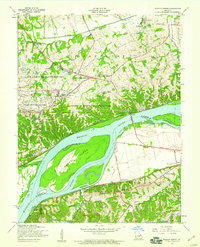
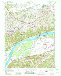
1954 Map of Weldon Spring
USGS Topo · Published 1959About this map
Weldon Spring Ordnance Works dominates the central landscape of this mid-century survey, reflecting the area's transition from rural agriculture to specialized industrial and institutional use. Bordered by the University of Missouri Experimental Farm and the August A Busch Memorial Wildlife Area, the region maintains a significant amount of open land north of the Missouri River. The waterway is split by the massive Howell Island, with a system of levees protecting the southern floodplains where the Chicago Rock Island and Pacific railroad serves small rail stops like Monarch Sta and Centaur.
Find a feature on this map
46 named features on this map. Tap any name to fly to it.
Don’t see what you’re looking for? This feature index may not catch every label — zoom into the map to look around manually.
Map Details
Editions of this 1954 Weldon Spring Map
5 editions found
Other maps of this area

1903 · O'Fallon
USGS Topo · 1:125,000

1931 · Manchester SE
USGS Topo · 1:24,000

1931 · Brussels
USGS Topo · 1:62,500

1932 · Manchester NE
USGS Topo · 1:24,000

1937 · Weldon Spring
USGS Topo · 1:24,000

1939 · Brussels
USGS Topo · 1:62,500

1940 · Eureka
USGS Topo · 1:24,000

1940 · Weldon Spring
USGS Topo · 1:24,000

1941 · Troy
USGS Topo · 1:62,500

1943 · Brussels
USGS Topo · 1:62,500