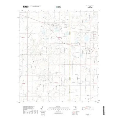
2021 Map of Wellborn
USGS Topo · Published 2021About this map
Wellborn serves as the primary hub in this Suwannee County landscape, where the local economy and geography are defined by a dense network of lakes and depressions. Natural features like Wellborn Lake, Bethea Lake, and the uniquely named Grissom Hole dot the terrain, reflecting the karst topography common to this part of Florida. The presence of the Wellborn Cemetery and McClellan Cemetery provide specific points of interest for genealogists tracing families in the area north of Stansel.
Find a feature on this map
141 named features on this map. Tap any name to fly to it.
Don’t see what you’re looking for? This feature index may not catch every label — zoom into the map to look around manually.
Map Details
Editions of this 2021 Wellborn Map
This is the sole edition of this map. No revisions or reprints were ever made.
Other maps of this area

1954 · Valdosta
USGS Topo · 1:250,000

1958 · Valdosta
USGS Topo · 1:250,000

1959 · Valdosta
USGS Topo · 1:250,000

1961 · Live Oak East
USGS Topo · 1:24,000

1961 · White Springs East
USGS Topo · 1:24,000

1961 · White Springs West
USGS Topo · 1:24,000

1963 · Columbia
USGS Topo · 1:24,000

1963 · Lake City West
USGS Topo · 1:24,000
1969 · Wellborn
USGS Topo · 1:24,000
1969 · O'Brien
USGS Topo · 1:24,000