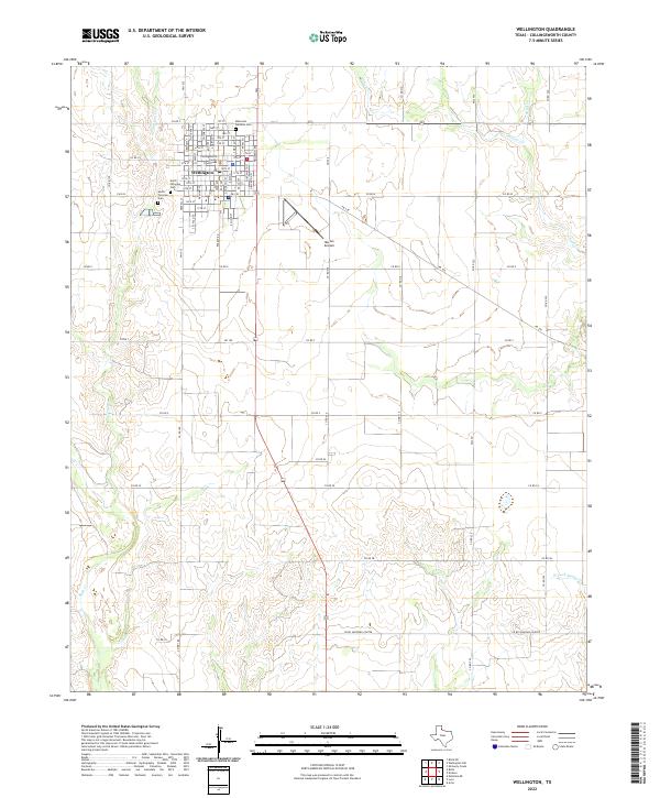
2022 Map of Wellington
USGS Topo · Published 2022About this map
Wellington serves as the focal point of this Collingsworth County landscape, where the town's grid is anchored by the Collingsworth County Courthouse. The surrounding Panhandle plains are defined by a network of drainage systems including House Log Cr, Willow Cr, and Sand Cr, which carve through the terrain south of the settlement. For those tracing local history, several burial grounds are documented, including Memorial Gardens Cem on the northern edge of town, and the North Fairview Cem and South Fairview Cem situated to the west. Transportation infrastructure is marked by the presence of Marian Airpark to the southeast, while an extensive grid of farm-to-market and county roads, such as FM 338 and CO RD Shopping Center, connects the agricultural hinterlands to the county seat.
Find a feature on this map
34 named features on this map. Tap any name to fly to it.
Don’t see what you’re looking for? This feature index may not catch every label — zoom into the map to look around manually.
Map Details
Editions of this 2022 Wellington Map
This is the sole edition of this map. No revisions or reprints were ever made.
Other maps of this area

1954 · Plainview
USGS Topo · 1:250,000

1958 · Plainview
USGS Topo · 1:250,000

1959 · Wellington NW
USGS Topo · 1:24,000

1959 · Shinnery Creek
USGS Topo · 1:24,000

1960 · Loco
USGS Topo · 1:62,500

1961 · Estelline
USGS Topo · 1:62,500

1964 · Rolla NE
USGS Topo · 1:24,000

1964 · Wellington
USGS Topo · 1:24,000

1964 · Dodson
USGS Topo · 1:24,000

1964 · Rolla
USGS Topo · 1:24,000