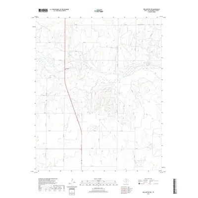
2019 Map of Wellington NW
USGS Topo · Published 2019About this map
The Salt Fork Red River meanders across the center of this Texas Panhandle landscape, shaping the local topography of Collingsworth County. This 2019 survey documents a rural environment where land use is structured by a geometric grid of county roads, such as Co RD M and Co RD S, which provide access to the drainages and intermittent streams that feed the main river channel. Notable water features include Cason Lake and numerous named tributaries like Indian Cr, Panther Cr, and Cottonwood Cr. The arterial backbone of the region is centered on the US 83 Bridge, where the highway crosses the riverbed. This map captures the modern pastoral character of the area, revealing how Ranch to Market roads and local farm-to-market routes like FM 3446 and FM 1981 connect the scattered homesteads and agricultural operations defined by the terrain's subtle relief.
Find a feature on this map
29 named features on this map. Tap any name to fly to it.
Don’t see what you’re looking for? This feature index may not catch every label — zoom into the map to look around manually.
Map Details
Editions of this 2019 Wellington NW Map
This is the sole edition of this map. No revisions or reprints were ever made.
Other maps of this area

1954 · Amarillo
USGS Topo · 1:250,000

1954 · Plainview
USGS Topo · 1:250,000

1958 · Amarillo
USGS Topo · 1:250,000

1958 · Plainview
USGS Topo · 1:250,000

1959 · Wellington NW
USGS Topo · 1:24,000

1959 · Shinnery Creek
USGS Topo · 1:24,000

1963 · Little Wolf Creek
USGS Topo · 1:24,000

1964 · Rolla NE
USGS Topo · 1:24,000

1964 · Wellington
USGS Topo · 1:24,000

1964 · Dodson
USGS Topo · 1:24,000