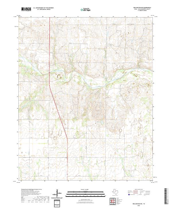
2022 Map of Wellington NW
USGS Topo · Published 2022About this map
The Salt Fork Red River meanders through this portion of Collingsworth County, defining the drainage patterns for a series of intermittent creeks that carve into the Texas Panhandle landscape. To the north, Indian Cr and Panther Cr feed toward the main river channel, while the southern terrain is marked by House Log Cr, Sand Cr, and the isolated Cason Lake. The map reveals a highly structured grid of rural infrastructure, where ranch roads such as Co RD M and C Ranch to Market Rd provide access to the expansive rangelands. This network of thoroughfares, including the more prominent FM 3446, underscores the area's continued reliance on a specialized road system to navigate the topographic relief created by the river's erosion.
Find a feature on this map
20 named features on this map. Tap any name to fly to it.
Don’t see what you’re looking for? This feature index may not catch every label — zoom into the map to look around manually.
Map Details
Editions of this 2022 Wellington NW Map
This is the sole edition of this map. No revisions or reprints were ever made.
Other maps of this area

1954 · Amarillo
USGS Topo · 1:250,000

1954 · Plainview
USGS Topo · 1:250,000

1958 · Amarillo
USGS Topo · 1:250,000

1958 · Plainview
USGS Topo · 1:250,000

1959 · Wellington NW
USGS Topo · 1:24,000

1959 · Shinnery Creek
USGS Topo · 1:24,000

1963 · Little Wolf Creek
USGS Topo · 1:24,000

1964 · Rolla NE
USGS Topo · 1:24,000

1964 · Wellington
USGS Topo · 1:24,000

1964 · Dodson
USGS Topo · 1:24,000