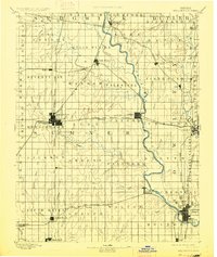
1890 Map of Wellington
USGS Topo · Published 1927About this map
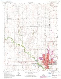
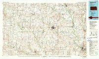
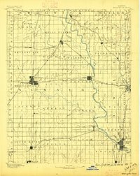
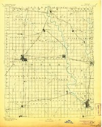
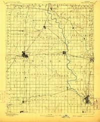
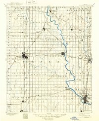
Wellington stands as a central rail hub in this late nineteenth-century portrait of Sumner and Cowley counties, where five distinct railroad lines converge to shape the local economy. The landscape is defined by the broad meander of the Arkansas River and the Chikaskia River, supporting a network of early settlements including Arkansas City and the therapeutic destination of Geuda Springs. Geographer Jno. H. Renshawe overseen this survey, documenting the transition of the Kansas prairie into a grid of organized townships like Seventy Six and Valverde. Notable for genealogists is the high density of small railroad stops and hamlets such as Cicero, Rome, and Hamden, many of which were vital community centers before the consolidation of the rural landscape. The map meticulously traces the paths of the Atchison Topeka and Santa Fe Railroad and the Missouri Pacific Railroad, illustrating the vital connection between the grain-producing plains and the growing urban markets.
Find a feature on this map
89 named features on this map. Tap any name to fly to it.
Don’t see what you’re looking for? This feature index may not catch every label — zoom into the map to look around manually.
Map Details
Editions of this 1890 Wellington Map
6 editions found

Historical Maps of Winfield Through Time
8 maps found