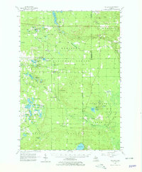
1957 Map of Wellston
USGS Topo · Published 1979About this map
Manistee National Forest dominates this landscape in the mid-1950s, a mosaic of timberland and water bodies defined by the Little Manistee River and Pine Creek. The area’s infrastructure is rooted in forestry and river management, evidenced by the presence of the Irons Lookout Tower and hydrological features like Tippy Dam Pond and Stronach Dam. Small communities such as Wellston, Irons, and Dublin serve as local hubs, connected by a network of roads and the local Railroad.
Find a feature on this map
82 named features on this map. Tap any name to fly to it.
Don’t see what you’re looking for? This feature index may not catch every label — zoom into the map to look around manually.
Map Details
Editions of this 1957 Wellston Map
3 editions found

Other maps of this area

1931 · Baldwin NW
USGS Topo · 1:31,680

1931 · Custer NE
USGS Topo · 1:31,680

1931 · Baldwin NE
USGS Topo · 1:31,680

1932 · Freesoil SE
USGS Topo · 1:31,680

1932 · Chase NW
USGS Topo · 1:31,680

1933 · Peacock SE
USGS Topo · 1:31,680

1933 · Peacock SW
USGS Topo · 1:31,680

1933 · Peacock NE
USGS Topo · 1:31,680

1933 · Luther SW
USGS Topo · 1:31,680

1933 · Luther NW
USGS Topo · 1:31,680