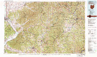
1980 Map of Wellston
USGS Topo · Published 1982About this map
Wayne National Forest and several state forests dominate this 1980s landscape across south-central Ohio, reflecting an era of conservation and reclamation in the state's rugged southeastern hills. The region’s deep industrial roots are evident in landmarks like the Buckeye Furnace State Memorial, while the persistence of early rural communities is documented through a network of country churches and cemeteries, such as Mount Zion Church and Bethel Cemetery.
Find a feature on this map
185 named features on this map. Tap any name to fly to it.
Don’t see what you’re looking for? This feature index may not catch every label — zoom into the map to look around manually.
Map Details
Editions of this 1980 Wellston Map
This is the sole edition of this map. No revisions or reprints were ever made.
Other maps of this area

1903 · Athens
USGS Topo · 1:62,500

1904 · Zaleski
USGS Topo · 1:62,500

1904 · Chesterhill
USGS Topo · 1:62,500

1905 · Athens
USGS Topo · 1:62,500

1905 · Wilkesville
USGS Topo · 1:62,500

1906 · Waverly
USGS Topo · 1:62,500

1906 · Chesterhill
USGS Topo · 1:62,500

1906 · Bidwell
USGS Topo · 1:62,500

1906 · Chillicothe
USGS Topo · 1:62,500

1907 · Pomeroy
USGS Topo · 1:62,500