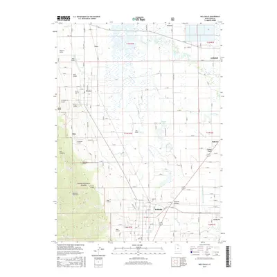
2017 Map of Wellsville
USGS Topo · Published 2017About this map
The Wellsville Mountains rise sharply along the western edge of this 2017 survey, casting long shadows over the fertile valley of the Logan River and Little Bear River. The landscape is a complex network of agricultural irrigation, featuring the Wellsville-Mendon Lower Canal and the Blacksmith Fork Hyrum Canal which support the long-established communities of Wellsville and Mendon. Within these settlements, the Wellsville Cem and Mendon City Cem serve as vital touchpoints for genealogical research in Cache County. The central valley floor, notably an area known as The Island, is characterized by the meandering Little Bear River and wetlands such as Pelican Pond and the Hyrum Slough. To the south, the Wellsville Reservoir and the rugged canyons of the Cache National Forest, including Pine Canyon and Brushy Canyon, illustrate the transition from valley agriculture to the steep wilderness of the Wasatch Range.
Find a feature on this map
87 named features on this map. Tap any name to fly to it.
Don’t see what you’re looking for? This feature index may not catch every label — zoom into the map to look around manually.
Map Details
Editions of this 2017 Wellsville Map
This is the sole edition of this map. No revisions or reprints were ever made.
Other maps of this area

1914 · Logan
USGS Topo · 1:125,000

1916 · Logan
USGS Topo · 1:125,000

1954 · Ogden
USGS Topo · 1:250,000

1954 · Brigham City
USGS Topo · 1:250,000

1955 · Paradise
USGS Topo · 1:24,000

1955 · Mount Pisgah
USGS Topo · 1:24,000

1955 · Brigham City
USGS Topo · 1:24,000

1958 · Ogden
USGS Topo · 1:250,000

1958 · Brigham City
USGS Topo · 1:250,000

1960 · Ogden
USGS Topo · 1:250,000