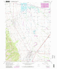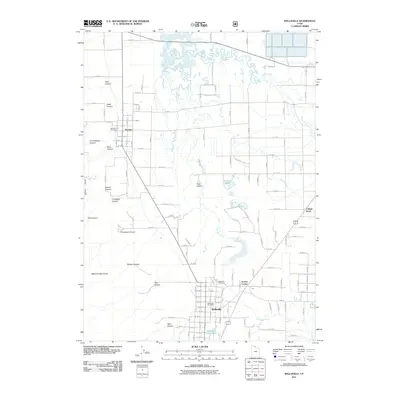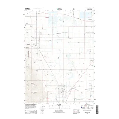
1998 Map of Wellsville
USGS Topo · Published 2001About this map
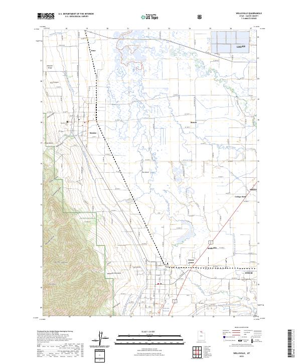
The Cache Valley floor dominates this 1998 revision, where the Little Bear River meanders through a landscape defined by its irrigation history. The agricultural character of the region is evident in the extensive network of the Wellsville Mendon Canal, Lower Canal, and Wellsville Upper Canal that support the settlements of Wellsville and Mendon. To the west, the steep rise of the Wellsville Mountains provides a stark boundary to the valley, protected within the Wellsville Mountain Wilderness and Cache National Forest.
Find a feature on this map
40 named features on this map. Tap any name to fly to it.
Don’t see what you’re looking for? This feature index may not catch every label — zoom into the map to look around manually.
Map Details
Editions of this 1998 Wellsville Map
This is the sole edition of this map. No revisions or reprints were ever made.
Historical Maps of Logan Through Time
7 maps found