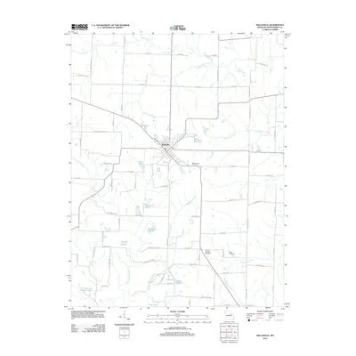
2012 Map of Wellsville
USGS Topo · Published 2012About this map
Wellsville serves as the central hub for this portion of Montgomery County, situated at a crossroads of regional routes like Co HWY-13 and S Madison ST. The landscape is defined by a dense network of small tributaries and man-made reservoirs, including City Lake, Wellsville Lake, and the uniquely named Ki-Wi Lake. This concentration of water resources, alongside features like Sportsman Lake and Zander Lake, suggests a rural economy shaped by both agricultural needs and local recreation in the early 21st century.
Find a feature on this map
80 named features on this map. Tap any name to fly to it.
Don’t see what you’re looking for? This feature index may not catch every label — zoom into the map to look around manually.
Map Details
Editions of this 2012 Wellsville Map
This is the sole edition of this map. No revisions or reprints were ever made.
Other maps of this area

1890 · Louisiana
USGS Topo · 1:125,000

1890 · Mexico
USGS Topo · 1:125,000

1890 · Hermann
USGS Topo · 1:125,000

1890 · Fulton
USGS Topo · 1:125,000

1940 · Montgomery City
USGS Topo · 1:62,500

1942 · Montgomery City
USGS Topo · 1:62,500

1942 · Wellsville
USGS Topo · 1:62,500

1942 · New Florence
USGS Topo · 1:62,500

1942 · Bellflower
USGS Topo · 1:62,500

1945 · Bellflower
USGS Topo · 1:62,500