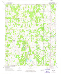
1973 Map of Welty
USGS Topo · Published 1976About this map
The Oil and Gas Field landscape of rural Okfuskee County is meticulously documented in this mid-1970s survey, illustrating a region shaped by energy extraction and agriculture. Small communities like Welty and Chilesville serve as local hubs, while numerous Oil Wells dot the terrain, particularly in the northern reaches near Spring Creek. The map provides significant detail for genealogists, marking several rural cemeteries such as Welty Cem and Find Cem, alongside spiritual centers including Highway Mission Ch and New Hope Ch.
Find a feature on this map
31 named features on this map. Tap any name to fly to it.
Don’t see what you’re looking for? This feature index may not catch every label — zoom into the map to look around manually.
Map Details
Editions of this 1973 Welty Map
This is the sole edition of this map. No revisions or reprints were ever made.
Other maps of this area

1896 · Seminole and Prague
USGS Topo · 1:125,000

1900 · Wewoka
USGS Topo · 1:125,000

1901 · Nuyaka
USGS Topo · 1:125,000

1929 · Stroud
USGS Topo · 1:62,500

1932 · Stroud
USGS Topo · 1:62,500

1954 · Oklahoma City
USGS Topo · 1:250,000

1957 · Oklahoma City
USGS Topo · 1:250,000

1963 · Oklahoma City
USGS Topo · 1:250,000

1967 · Prague NE
USGS Topo · 1:24,000

1967 · Okemah
USGS Topo · 1:24,000