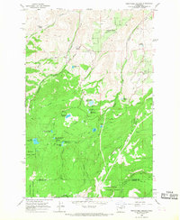
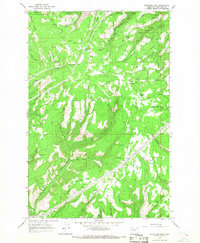
1966 Map of Wenatchee Heights
USGS Topo · Published 1968About this map
Wenatchee Heights and the surrounding high country in Chelan and Kittitas Counties define a landscape dominated by complex water management and high-altitude ranching during the mid-1960s. The map reveals an intricate network of irrigation and storage, featuring Steffen Bros Reservoir, Milo Wood Pond, and the Stemilt Project Reservoir system. These catchments, along with several reservoirs named for Wenatchee Heights, illustrate the critical importance of water rights and storage for the orchards and farms on the plateau above Pitcher Canyon.
Find a feature on this map
40 named features on this map. Tap any name to fly to it.
Don’t see what you’re looking for? This feature index may not catch every label — zoom into the map to look around manually.
Map Details
Editions of this 1966 Wenatchee Heights Map
4 editions found
Other maps of this area

1912 · Malaga
USGS Topo · 1:48,000

1913 · Wenatchee
USGS Topo · 1:62,500

1914 · Malaga
USGS Topo · 1:62,500

1915 · Wenatchee
USGS Topo · 1:62,500

1920 · Colockum Pass
USGS Topo · 1:125,000

1922 · Colockum Pass
USGS Topo · 1:125,000

1957 · Wenatchee
USGS Topo · 1:250,000

1966 · Rock Island
USGS Topo · 1:24,000

1966 · Wenatchee
USGS Topo · 1:24,000
1966 · Colockum Pass
USGS Topo · 1:24,000