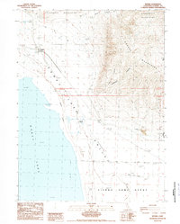
1988 Map of Wendel
USGS Topo · Published 1989About this map
The Honey Lake shoreline and the eastern reaches of the Honey Lake Valley anchor this late-1980s landscape, where the transition from desert floor to the high peaks of the Amedee Mountains and Skedaddle Mountains is marked by geothermal activity and military infrastructure. The small settlement at Wendel is noted with its post office, positioned along the Old Railroad Grade that traces the valley edge. A significant portion of the southern map is occupied by the Sierra Army Depot, including the Amedee Army Airfield and a dedicated Radio Facility.
Find a feature on this map
19 named features on this map. Tap any name to fly to it.
Don’t see what you’re looking for? This feature index may not catch every label — zoom into the map to look around manually.
Map Details
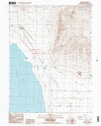
Editions of this 1988 Wendel Map
2 editions found
Other maps of this area

1886 · Honey Lake
USGS Topo · 1:250,000

1891 · Honey Lake
USGS Topo · 1:250,000

1893 · Honey Lake
USGS Topo · 1:250,000

1950 · Milford
USGS Topo · 1:62,500

1954 · Wendel
USGS Topo · 1:62,500

1954 · Litchfield
USGS Topo · 1:62,500

1954 · Doyle
USGS Topo · 1:62,500

1955 · Westwood
USGS Topo · 1:250,000

1958 · Westwood
USGS Topo · 1:250,000

1959 · Westwood
USGS Topo · 1:250,000