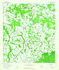
1944 Map of Wesley Chapel
USGS Topo · Published 1961About this map
Wesley Chapel and the surrounding pine flatwoods of the Florida interior are defined by a complex mosaic of wetlands and small lakes in this mid-1940s survey. The landscape is split by the Pasco Co Hillsborough Co line, showing the region before the era of intensive suburban development. To the south, the Hillsborough River snakes through the corner of the map, buffered by the dense woodlands of Hillsborough State Park. The settlement of Branchton sits near the river's edge, highlighting the early rural nodes of the county. This mapping, based on 1942 aerial photography, captures the hydrological network of Trout Creek and dozens of unnamed ponds that once characterized this section of the peninsula.
Find a feature on this map
6 named features on this map. Tap any name to fly to it.
Don’t see what you’re looking for? This feature index may not catch every label — zoom into the map to look around manually.
Map Details
Editions of this 1944 Wesley Chapel Map
3 editions found
Other maps of this area

1943 · Thonotosassa
USGS Topo · 1:24,000

1943 · Lutz
USGS Topo · 1:24,000

1944 · Sulphur Springs
USGS Topo · 1:31,680

1944 · Wesley Chapel
USGS Topo · 1:31,680

1944 · Lutz
USGS Topo · 1:31,680

1944 · Thonotosassa
USGS Topo · 1:31,680

1944 · Antioch
USGS Topo · 1:31,680

1945 · Sulphur Springs
USGS Topo · 1:31,680

1947 · Zephyrhills
USGS Topo · 1:24,000
1949 · Sulphur Springs
USGS Topo · 1:25,000