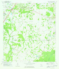
1973 Map of Wesley Chapel
USGS Topo · Published 1976About this map
Wesley Chapel and the surrounding pine and cypress flatlands are captured here in the early 1970s, as the rural landscape began transitioning toward suburban development. The map details a complex drainage network where Cabbage Swamp feeds into Trout Creek, eventually meeting the Hillsborough River at the southern boundary. This area, spanning the border of Pasco and Hillsborough counties, shows established residential pockets like Trader Park and Branchton alongside newer recreation-focused features such as Quail Hollow Country Club and the Pebble Creek Country Club.
Find a feature on this map
24 named features on this map. Tap any name to fly to it.
Don’t see what you’re looking for? This feature index may not catch every label — zoom into the map to look around manually.
Map Details
Editions of this 1973 Wesley Chapel Map
3 editions found
Other maps of this area

1943 · Thonotosassa
USGS Topo · 1:24,000

1943 · Lutz
USGS Topo · 1:24,000

1944 · Sulphur Springs
USGS Topo · 1:31,680

1944 · Wesley Chapel
USGS Topo · 1:31,680

1944 · Lutz
USGS Topo · 1:31,680

1944 · Thonotosassa
USGS Topo · 1:31,680

1944 · Antioch
USGS Topo · 1:31,680

1945 · Sulphur Springs
USGS Topo · 1:31,680

1947 · Zephyrhills
USGS Topo · 1:24,000
1949 · Sulphur Springs
USGS Topo · 1:25,000