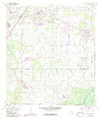
1973 Map of Wesley Chapel
USGS Topo · Published 1987About this map
Wesley Chapel serves as the focal point for this survey of the Central Florida interior during the 1970s and 1980s. The landscape is defined by the transition from cattle country and citrus groves to suburban development, with leisure-oriented additions like the Quail Hollow Country Club and Pebble Creek Country Club emerging among the wetlands. The eastern boundary is marked by the Hillsborough River and the northern reaches of Hillsborough River State Park, while the New River and Cypress Creek drainage systems dominate the local topography.
Find a feature on this map
23 named features on this map. Tap any name to fly to it.
Don’t see what you’re looking for? This feature index may not catch every label — zoom into the map to look around manually.
Map Details
Editions of this 1973 Wesley Chapel Map
3 editions found
Other maps of this area

1943 · Thonotosassa
USGS Topo · 1:24,000

1943 · Lutz
USGS Topo · 1:24,000

1944 · Sulphur Springs
USGS Topo · 1:31,680

1944 · Wesley Chapel
USGS Topo · 1:31,680

1944 · Lutz
USGS Topo · 1:31,680

1944 · Thonotosassa
USGS Topo · 1:31,680

1944 · Antioch
USGS Topo · 1:31,680

1945 · Sulphur Springs
USGS Topo · 1:31,680

1947 · Zephyrhills
USGS Topo · 1:24,000
1949 · Sulphur Springs
USGS Topo · 1:25,000