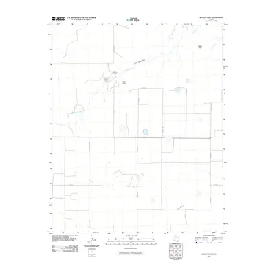
2010 Map of Wesley Point
USGS Topo · Published 2010About this map
Cita Canyon dominates the northern reaches of this High Plains landscape, where the seasonal waters of South Cita Creek have carved a significant relief into the terrain. The presence of Cita Canyon Methodist Camp and Cita Glen Christian Camp indicates the area's role as a regional retreat center, situated near the dramatic drop-offs of the canyon rim. To the west, Stanley Schaeffer Lake serves as a distinct hydrological marker in an otherwise grid-defined agricultural environment. The map details a transition from the structured section lines of the Texas Panhandle, defined by routes like Pullman Rd and FM 1721, into the natural drainage systems of Curry Draw and Happy Draw. Near the northeastern corner, the topographic prominence of Wesley Point overlooks the confluence of local creek beds including Antibust Creek, providing a clear look at the geological edge where the flat plains meet the breaks.
Find a feature on this map
26 named features on this map. Tap any name to fly to it.
Don’t see what you’re looking for? This feature index may not catch every label — zoom into the map to look around manually.
Map Details
Editions of this 2010 Wesley Point Map
This is the sole edition of this map. No revisions or reprints were ever made.
Other maps of this area

1954 · Plainview
USGS Topo · 1:250,000

1956 · Fortress Cliff
USGS Topo · 1:24,000

1958 · Plainview
USGS Topo · 1:250,000

1960 · Canyon
USGS Topo · 1:62,500

1960 · Wayside
USGS Topo · 1:62,500

1965 · Happy
USGS Topo · 1:24,000

1969 · Jackson Hill
USGS Topo · 1:24,000

1969 · Tule Lake NW
USGS Topo · 1:24,000
1984 · Pony Flats
USGS Topo · 1:24,000
1984 · Wesley Point
USGS Topo · 1:24,000