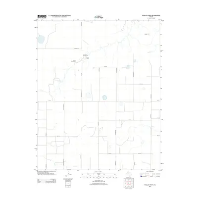
2012 Map of Wesley Point
USGS Topo · Published 2012About this map
Wesley Point and the surrounding Panhandle plains are defined by the deep incisions of the Cita Creek drainage system, which breaks the otherwise orderly grid of rural section roads. This 2012 survey documents a landscape where institutional retreats and agricultural interests converge near the rim of the canyon breaks. The presence of Cita Canyon Methodist Camp and Cita Glen Christian Camp highlights the area's long-standing use for summer camps and spiritual gatherings, positioned to take advantage of the dramatic geography created by S Cita Cr. Water management is central to life here, evidenced by Stanley Schaeffer Lake and various named drainages like Curry Draw and Antibust Cr. The road network, including the specifically named Juett Attebury Rd and Goathead Rd, reflects a history of family ranching and land ownership in Randall County.
Find a feature on this map
26 named features on this map. Tap any name to fly to it.
Don’t see what you’re looking for? This feature index may not catch every label — zoom into the map to look around manually.
Map Details
Editions of this 2012 Wesley Point Map
This is the sole edition of this map. No revisions or reprints were ever made.
Other maps of this area

1954 · Plainview
USGS Topo · 1:250,000

1956 · Fortress Cliff
USGS Topo · 1:24,000

1958 · Plainview
USGS Topo · 1:250,000

1960 · Canyon
USGS Topo · 1:62,500

1960 · Wayside
USGS Topo · 1:62,500

1965 · Happy
USGS Topo · 1:24,000

1969 · Jackson Hill
USGS Topo · 1:24,000

1969 · Tule Lake NW
USGS Topo · 1:24,000
1984 · Pony Flats
USGS Topo · 1:24,000
1984 · Wesley Point
USGS Topo · 1:24,000