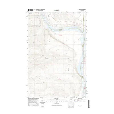
2014 Map of West Bar
USGS Topo · Published 2014About this map
Wanapum Lake dominates this stretch of the Columbia River corridor, illustrating the managed water system of Central Washington in the early twenty-first century. This portion of the river, bordering Grant, Kittitas, and Douglas counties near Trinidad, represents a landscape defined by dramatic elevation changes between the high basalt plateaus and the reservoir's shoreline. The topography reveals the complex drainage patterns of the Columbia Basin, where the river's flow is contained within a steep-walled canyon. This 2014 representation focuses on the hydrological and land-management boundaries of the region, providing a clear view of the relationship between the reservoir and the surrounding high desert terrain.
Find a feature on this map
1 named feature on this map. Tap any name to fly to it.
Don’t see what you’re looking for? This feature index may not catch every label — zoom into the map to look around manually.
Map Details
Editions of this 2014 West Bar Map
This is the sole edition of this map. No revisions or reprints were ever made.
Other maps of this area

1909 · Quincy
USGS Topo · 1:62,500

1910 · Quincy
USGS Topo · 1:62,500

1912 · Malaga
USGS Topo · 1:48,000

1914 · Malaga
USGS Topo · 1:62,500

1920 · Colockum Pass
USGS Topo · 1:125,000

1922 · Colockum Pass
USGS Topo · 1:125,000

1953 · Ritzville
USGS Topo · 1:250,000

1957 · Wenatchee
USGS Topo · 1:250,000

1959 · Ritzville
USGS Topo · 1:250,000

1965 · Ritzville
USGS Topo · 1:250,000