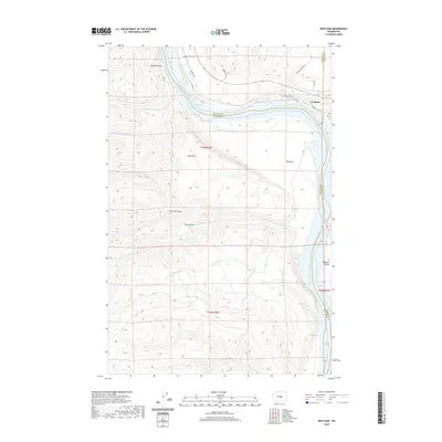
2020 Map of West Bar
USGS Topo · Published 2020About this map
Trinidad sits on the high eastern bluffs overlooking a dramatic bend in the Columbia River, known here as Wanapum Lake. The landscape is defined by the sharp verticality of the coulee country, where the river has carved deep into the basalt, leaving behind significant river-side features like the broad expanse of West Bar and the elevated Babcock Bench. Three counties—Grant, Douglas, and Kittitas—converge along the river's path, marking a point where administrative boundaries follow the natural hydrology of the basin.
Find a feature on this map
29 named features on this map. Tap any name to fly to it.
Don’t see what you’re looking for? This feature index may not catch every label — zoom into the map to look around manually.
Map Details
Editions of this 2020 West Bar Map
This is the sole edition of this map. No revisions or reprints were ever made.
Other maps of this area

1909 · Quincy
USGS Topo · 1:62,500

1910 · Quincy
USGS Topo · 1:62,500

1912 · Malaga
USGS Topo · 1:48,000

1914 · Malaga
USGS Topo · 1:62,500

1920 · Colockum Pass
USGS Topo · 1:125,000

1922 · Colockum Pass
USGS Topo · 1:125,000

1953 · Ritzville
USGS Topo · 1:250,000

1957 · Wenatchee
USGS Topo · 1:250,000

1959 · Ritzville
USGS Topo · 1:250,000

1965 · Ritzville
USGS Topo · 1:250,000