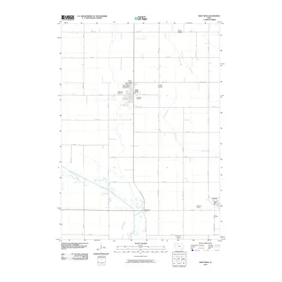
2010 Map of West Bend
USGS Topo · Published 2010About this map
The Grotto of the Redemption serves as a prominent landmark in the town of West Bend, reflecting the religious and cultural heritage of this Iowa community. This landscape is defined by the winding course of the Des Moines River and its tributaries, including Lotts Creek and Trulner Creek. The map documents a predominantly agricultural region organized by a strict grid of section roads like 450th St and Colorado Ave, interspersed with natural preserves such as Banwart Prairie. Genealogists will find significant value in the distribution of local burial grounds, ranging from the Garfield Township Cemetery in the north to the Omer-Thorsen Farm Cemetery further south. The settlement of Ottosen anchors the southeastern corner, while landmarks like McKnights Point offer specific points of interest for historical land-use research.
Find a feature on this map
45 named features on this map. Tap any name to fly to it.
Don’t see what you’re looking for? This feature index may not catch every label — zoom into the map to look around manually.
Map Details
Editions of this 2010 West Bend Map
This is the sole edition of this map. No revisions or reprints were ever made.
Other maps of this area

1954 · Fairmont
USGS Topo · 1:250,000

1954 · Fort Dodge
USGS Topo · 1:250,000

1957 · Fort Dodge
USGS Topo · 1:250,000

1958 · Fort Dodge
USGS Topo · 1:250,000

1958 · Fairmont
USGS Topo · 1:250,000

1980 · Rolfe
USGS Topo · 1:24,000

1980 · Plover
USGS Topo · 1:24,000

1980 · Hobarton
USGS Topo · 1:24,000

1980 · West Bend
USGS Topo · 1:24,000
1980 · Bode
USGS Topo · 1:24,000