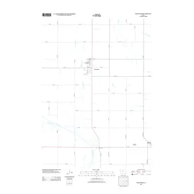
2013 Map of West Bend
USGS Topo · Published 2013About this map
West Bend serves as the primary hub in this agricultural landscape of northern Iowa, defined by its rectilinear grid of section roads and complex drainage network. A significant local landmark is the Grotto of the Redemption, situated on the northern edge of the town along with the Grotto of the Redemption Campground. This religious site represents a unique piece of regional cultural history set against the backdrop of the Iowa plains.
Find a feature on this map
48 named features on this map. Tap any name to fly to it.
Don’t see what you’re looking for? This feature index may not catch every label — zoom into the map to look around manually.
Map Details
Editions of this 2013 West Bend Map
This is the sole edition of this map. No revisions or reprints were ever made.
Other maps of this area

1954 · Fairmont
USGS Topo · 1:250,000

1954 · Fort Dodge
USGS Topo · 1:250,000

1957 · Fort Dodge
USGS Topo · 1:250,000

1958 · Fort Dodge
USGS Topo · 1:250,000

1958 · Fairmont
USGS Topo · 1:250,000

1980 · Rolfe
USGS Topo · 1:24,000

1980 · Plover
USGS Topo · 1:24,000

1980 · Hobarton
USGS Topo · 1:24,000

1980 · West Bend
USGS Topo · 1:24,000
1980 · Bode
USGS Topo · 1:24,000