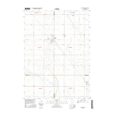
2015 Map of West Bend
USGS Topo · Published 2015About this map
West Bend and Ottosen anchor this agricultural landscape at the convergence of four North Iowa counties. The terrain is defined by a systematic network of drainage improvements, such as Ditch Number 61 and Ditch Number 79, which transformed the prairie into productive farmland. The Des Moines River cuts through the southern portion of the quadrangle, joined by tributaries like Trulner Cr and Lotts Cr. Local history is preserved in several rural burial grounds, including Garfield Township Cem and the Apostolic Christian Cem. This map illustrates the intersection of Palo Alto, Kossuth, Pocahontas, and Humboldt counties, where the rectilinear grid of county highways and local roads like Co HWY b63 and State Hwy 15 provides the primary structure for the region's transport and settlement.
Find a feature on this map
45 named features on this map. Tap any name to fly to it.
Don’t see what you’re looking for? This feature index may not catch every label — zoom into the map to look around manually.
Map Details
Editions of this 2015 West Bend Map
This is the sole edition of this map. No revisions or reprints were ever made.
Other maps of this area

1954 · Fairmont
USGS Topo · 1:250,000

1954 · Fort Dodge
USGS Topo · 1:250,000

1957 · Fort Dodge
USGS Topo · 1:250,000

1958 · Fort Dodge
USGS Topo · 1:250,000

1958 · Fairmont
USGS Topo · 1:250,000

1980 · Rolfe
USGS Topo · 1:24,000

1980 · Plover
USGS Topo · 1:24,000

1980 · Hobarton
USGS Topo · 1:24,000

1980 · West Bend
USGS Topo · 1:24,000
1980 · Bode
USGS Topo · 1:24,000