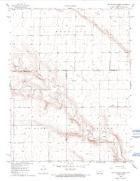
1968 Map of West Bethany Church
USGS Topo · Published 1993About this map
Harrison Flats dominates the high, level ground of this western Kansas landscape, providing a stark contrast to the deeply incised drainage of the Ladder Creek system. Situated at the junction of Wallace, Greeley, and Wichita Counties, the area is characterized by vast stretches of open country punctuated by small-scale industrial markers like a Sandpit and Gravel Pit. The West Bethany Ch stands as a primary community landmark near the boundary of Wallace and Wichita counties, serving as a focal point for the surrounding rural homesteads. The water network is defined by the winding paths of Chalk Creek and South Ladder Creek, which carve distinct topographic depressions into the high plains. The map reflects a mid-century agricultural landscape where section lines and isolated wells dictate the pattern of human activity across the wide prairie.
Find a feature on this map
16 named features on this map. Tap any name to fly to it.
Don’t see what you’re looking for? This feature index may not catch every label — zoom into the map to look around manually.
Map Details
Editions of this 1968 West Bethany Church Map
2 editions found
Other maps of this area

1955 · Scott City
USGS Topo · 1:250,000

1958 · Scott City
USGS Topo · 1:250,000

1959 · Wallace
USGS Topo · 1:62,500

1968 · Russell Springs 3 SW
USGS Topo · 1:24,000

1968 · Russell Springs 3 NW
USGS Topo · 1:24,000

1968 · Sharon Springs 4 NW
USGS Topo · 1:24,000

1968 · Sharon Springs 4 NE
USGS Topo · 1:24,000

1969 · Russell Springs 2 SW
USGS Topo · 1:24,000

1970 · Sharon Springs 4 SE
USGS Topo · 1:24,000

1970 · Sharon Springs 4 SW
USGS Topo · 1:24,000