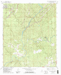
1980 Map of West Blocton East
USGS Topo · Published 1980About this map
The Cahaba River and Little Cahaba River carve through a landscape defined by industrial coal extraction and small-scale settlement near West Blocton. Extensive Strip Mine operations and a Tailings Pond dominate the northwestern sector, showing the heavy hand of resource extraction on the terrain. In contrast, the surrounding hills are dotted with local landmarks of genealogical significance, including Shiny Rock Cem, Cottingham Cem, and Thompson Cem. The geography is further anchored by community centers like Schultz Creek Ch and Wesley Chapel. The presence of numerous Gravel Pit sites alongside the major rivers suggests a diverse mineral economy that supported local infrastructure during the late 1970s. These waterways, fed by creeks such as Schultz Creek and Sixmile Creek, remain the primary topographic features around which the smaller communities of Coleanor and Piper were established.
Find a feature on this map
34 named features on this map. Tap any name to fly to it.
Don’t see what you’re looking for? This feature index may not catch every label — zoom into the map to look around manually.
Map Details
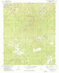
Editions of this 1980 West Blocton East Map
2 editions found
Other maps of this area

1890 · Bessemer
USGS Topo · 1:125,000

1891 · Clanton
USGS Topo · 1:125,000

1892 · Bessemer
USGS Topo · 1:125,000

1899 · Brookwood
USGS Topo · 1:125,000

1910 · Montevallo
USGS Topo · 1:62,500

1934 · Blocton
USGS Topo · 1:48,000

1940 · Blocton
USGS Topo · 1:62,500

1953 · Montgomery
USGS Topo · 1:250,000

1953 · Birmingham
USGS Topo · 1:250,000

1956 · Birmingham
USGS Topo · 1:250,000