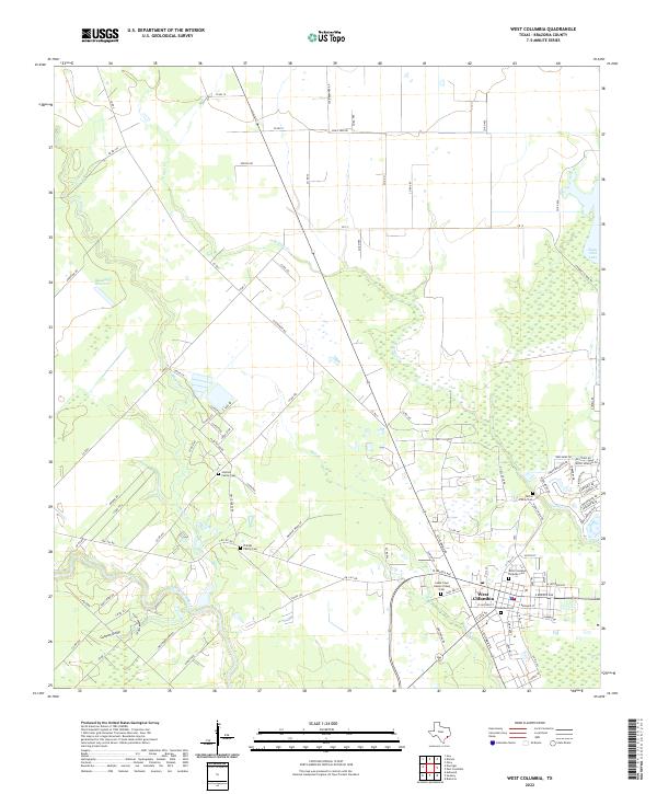
2022 Map of West Columbia
USGS Topo · Published 2022About this map
West Columbia serves as the focal point of this Brazoria County landscape, situated where the meandering San Bernard River and Varner Cr define the local topography. This region is notably dense with genealogical sites, including a cluster of historic burial grounds such as the Patton Family Cem and the Johnson Family Cem. The layout of the land reflects a transition from the structured street grid of the town center to the sprawling agricultural tracts and wetlands further afield. To the north and west, hydrological features like Mound Cr and the Blackwell Reservoir punctuate the coastal plain, while drainage ways like Bell Cr and Cannon Gully feed into the river system. The map records a modern road network including FM 1301 Rd and Louis Ferry Rd, which together with the local cemeteries, offer a clear view of the area's settled history and enduring land use patterns.
Find a feature on this map
97 named features on this map. Tap any name to fly to it.
Don’t see what you’re looking for? This feature index may not catch every label — zoom into the map to look around manually.
Map Details
Editions of this 2022 West Columbia Map
This is the sole edition of this map. No revisions or reprints were ever made.
Other maps of this area

1950 · Houston
USGS Topo · 1:250,000

1952 · West Columbia
USGS Topo · 1:24,000

1952 · Sweeny
USGS Topo · 1:24,000

1952 · Danciger
USGS Topo · 1:24,000

1952 · Ashwood
USGS Topo · 1:24,000

1952 · East Columbia
USGS Topo · 1:24,000

1952 · Brazoria
USGS Topo · 1:24,000

1953 · Guy
USGS Topo · 1:24,000

1953 · Damon
USGS Topo · 1:24,000

1953 · Otey
USGS Topo · 1:24,000