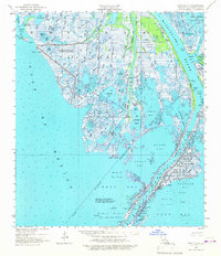
1958 Map of West Delta
USGS Topo · Published 1967About this map
Pilottown stands as the primary human outpost in this 1958 survey of the lower Mississippi River delta, where the river's Main Pass and Cubits Gap give way to the Gulf of Mexico. This landscape is defined by the transition between land and water, featuring an intricate network of bays like Chawee Bay and Zinzin Bay, and numerous ponds including Andres Pond, Locust Pond, and Buras Pond. The map reveals the era's critical maritime and industrial infrastructure, from the Old Quarantine Station and Quarantine Cupola near the riverbank to the expansive offshore Oil and Gas Fields designated in blocks. Conservation areas such as the Delta National Wildlife Refuge and the Tern Islands bird sanctuary illustrate the environmental significance of these marshes. Navigational markers like the Head of Passes Gage and Sandy Pt. Bay Ent. Light reflect the constant management required for the shipping lanes of Plaquemines Parish.
Find a feature on this map
66 named features on this map. Tap any name to fly to it.
Don’t see what you’re looking for? This feature index may not catch every label — zoom into the map to look around manually.
Map Details
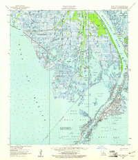
Editions of this 1958 West Delta Map
2 editions found
Other maps of this area

1892 · Quarantine
USGS Topo · 1:62,500

1893 · East Delta
USGS Topo · 1:62,500

1893 · Forts
USGS Topo · 1:62,500

1893 · West Delta
USGS Topo · 1:62,500

1935 · South Pass
USGS Topo · 1:31,680

1941 · Empire
USGS Topo · 1:62,500

1944 · Empire
USGS Topo · 1:62,500

1946 · Pass Du Bois
USGS Topo · 1:31,680

1946 · Mudpan Bayou
USGS Topo · 1:31,680

1946 · Pass Tante Phine
USGS Topo · 1:31,680