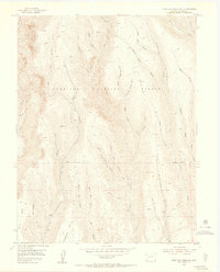
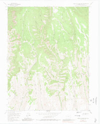
1954 Map of West Elk Peak SW
USGS Topo · Published 1955About this map
Gunnison National Forest dominates this mid-century topographic study, revealing a landscape defined by sharp drainage basins and high-elevation gulches. The terrain is deeply incised by watercourses such as West Elk Creek and Willow Creek, with the map detailing the complex network of intermittent streams and forks that feed the larger Gunnison river system. Notable landmarks like Tenderfoot Hill and Dillon Mesa anchor the southern portion of the sheet, where the high-altitude topography levels out slightly. Historical resource extraction or processing is suggested by the naming of Slab Mill Gulch and Burnt Mill Gulch in the northern sector. The map also traces a series of rugged transport routes, including a Jeep Trail that navigates the steep divide near Deadman Gulch and Frying Pan Creek, providing a look at how this backcountry was accessed before modern development.
Find a feature on this map
27 named features on this map. Tap any name to fly to it.
Don’t see what you’re looking for? This feature index may not catch every label — zoom into the map to look around manually.
Map Details
Editions of this 1954 West Elk Peak SW Map
6 editions found
Other maps of this area

1908 · Uncompahgre
USGS Topo · 1:125,000

1911 · Uncompahgre
USGS Topo · 1:125,000

1954 · Iola
USGS Topo · 1:24,000

1954 · Mc Intosh Mountain
USGS Topo · 1:24,000

1954 · West Elk Peak SW
USGS Topo · 1:24,000

1954 · Little Soap Park
USGS Topo · 1:24,000

1954 · Cebolla
USGS Topo · 1:24,000

1954 · Sapinero
USGS Topo · 1:24,000

1956 · Montrose
USGS Topo · 1:250,000

1959 · Montrose
USGS Topo · 1:250,000