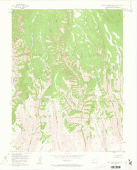
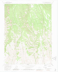
1954 Map of West Elk Peak SW
USGS Topo · Published 1963About this map
Gunnison National Forest dominates this mid-century topographic study, revealing a complex drainage system defined by the West Elk Creek watershed. The geography is characterized by deep, branching ravines such as Poison Gulch and Slab Mill Gulch, reflecting a landscape heavily shaped by seasonal water runoff and timber history. In the south, the terrain levels into features like Mesa and the prominent Tenderfoot Hill, marking the transition from high-elevation peaks toward broader valley floors.
Find a feature on this map
35 named features on this map. Tap any name to fly to it.
Don’t see what you’re looking for? This feature index may not catch every label — zoom into the map to look around manually.
Map Details
Editions of this 1954 West Elk Peak SW Map
6 editions found
Other maps of this area

1908 · Uncompahgre
USGS Topo · 1:125,000

1911 · Uncompahgre
USGS Topo · 1:125,000

1954 · Iola
USGS Topo · 1:24,000

1954 · Mc Intosh Mountain
USGS Topo · 1:24,000

1954 · West Elk Peak SW
USGS Topo · 1:24,000

1954 · Little Soap Park
USGS Topo · 1:24,000

1954 · Cebolla
USGS Topo · 1:24,000

1954 · Sapinero
USGS Topo · 1:24,000

1956 · Montrose
USGS Topo · 1:250,000

1959 · Montrose
USGS Topo · 1:250,000