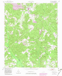
1949 Map of West End
USGS Topo · Published 1983About this map
The Norfolk Southern railroad serves as the industrial spine for this Moore County landscape, anchoring the settlement of West End and nearby Edgewood Terrace. Surveyed in the late 1940s with early 1980s updates, the map documents a transition from traditional rural agriculture toward modern land management, notably within the vast Sandhills Game Land that occupies much of the southern reach. The terrain is marked by numerous water features like Von Canon Lake and the planned development of Auman Lake.
Find a feature on this map
21 named features on this map. Tap any name to fly to it.
Don’t see what you’re looking for? This feature index may not catch every label — zoom into the map to look around manually.
Map Details
Editions of this 1949 West End Map
3 editions found
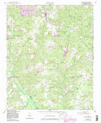
Other maps of this area

1942 · Troy
USGS Topo · 1:125,000

1948 · Southern Pines
USGS Topo · 1:62,500

1948 · Pinebluff
USGS Topo · 1:24,000

1949 · Millstone Lake
USGS Topo · 1:24,000

1949 · West End
USGS Topo · 1:24,000

1949 · Hoffman
USGS Topo · 1:24,000

1949 · Jackson Springs
USGS Topo · 1:62,500

1950 · Pine Bluff
USGS Topo · 1:24,000

1950 · Southern Pines
USGS Topo · 1:24,000

1950 · Norman
USGS Topo · 1:24,000