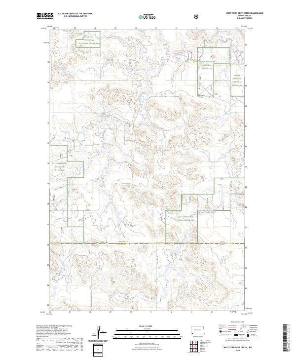
2024 Map of West Fork Deep Creek
USGS Topo · Published 2024About this map
Little Missouri National Grassland tracts dominate this corner of the North Dakota badlands, where the landscape is defined by the complex drainage of the Deep Creek system. The topography is shaped by the West Fork Deep Creek and East Fork Deep Creek, which carve through the high plains to create a network of coulees and ridges. This map documents the remote borderland where the Slope Co Bowman Co line divides the terrain, providing a contemporary view of land management and access in a region primarily used for grazing and conservation. Sparse infrastructure consists mostly of section-line roads like 156th Ave SW and 154th Ave SW, reflecting the enduring rural character of the southwestern corner of the state.
Find a feature on this map
14 named features on this map. Tap any name to fly to it.
Don’t see what you’re looking for? This feature index may not catch every label — zoom into the map to look around manually.
Map Details
Editions of this 2024 West Fork Deep Creek Map
This is the sole edition of this map. No revisions or reprints were ever made.
Other maps of this area

1953 · Dickinson
USGS Topo · 1:250,000

1957 · Dickinson
USGS Topo · 1:250,000

1968 · Bowman
USGS Topo · 1:24,000

1973 · Black Butte
USGS Topo · 1:24,000

1973 · Stewart Lake
USGS Topo · 1:24,000

1973 · Griffin
USGS Topo · 1:24,000

1973 · Rhame
USGS Topo · 1:24,000

1979 · Ives
USGS Topo · 1:24,000

1981 · Bowman
USGS Topo · 1:100,000
1997 · Stewart Lake
USGS Topo · 1:24,000