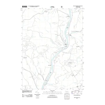
2011 Map of West Hickory
USGS Topo · Published 2011About this map
The Allegheny River carves a deep valley through this portion of Forest County, serving as the primary geographic corridor for a string of riverside settlements. Small hamlets like Trunkeyville, West Hickory, and Jamison are tucked against the river's banks, while the local economy is anchored by the Endeavor Post Office and West Hickory Post Office. The terrain is defined by steep ridges and numerous tributary runs, such as West Hickory Creek and Pithole Creek, which drain into the main waterway. Named landforms like Butcherknife Hill and Preacher Hill rise above the narrow floodplains, while Hemlock Island and Baker Island punctuate the river's course. This mapping shows the distribution of local infrastructure, from Lalich Field near the river to the upland settlement at Church Hill, illustrating a landscape where topography strictly dictates the path of roads like Trunkeyville Rd and the placement of communities.
Find a feature on this map
62 named features on this map. Tap any name to fly to it.
Don’t see what you’re looking for? This feature index may not catch every label — zoom into the map to look around manually.
Map Details
Editions of this 2011 West Hickory Map
This is the sole edition of this map. No revisions or reprints were ever made.
Other maps of this area

1922 · Oil City
USGS Topo · 1:48,000

1922 · Tionesta
USGS Topo · 1:62,500

1924 · Oil City
USGS Topo · 1:62,500

1924 · Tionesta
USGS Topo · 1:62,500

1927 · Tidioute
USGS Topo · 1:48,000

1927 · Titusville
USGS Topo · 1:62,500

1930 · Tidioute
USGS Topo · 1:62,500

1933 · Titusville
USGS Topo · 1:62,500

1943 · Oil City
USGS Topo · 1:62,500

1946 · Tionesta
USGS Topo · 1:62,500
Featured Places
- Tionesta, PA
- Triumph Township, PA
- Tionesta Township, PA
- Trunkeyville, Harmony Township
- Church Hill, Hickory Township