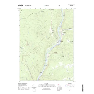
2019 Map of West Hickory
USGS Topo · Published 2019About this map
The Allegheny River defines the geography of this Forest County corridor, winding south through the Allegheny National Forest. This protected landscape is characterized by its numerous islands, including Hemlock Island and King Island, and the designated Allegheny Wild and Scenic River corridor. The riverbanks are dotted with small settlements like West Hickory, East Hickory, and Trunkeyville, where local history is preserved in a high concentration of family and community burial grounds such as the Prather Family Cem and Siggins Family Cem.
Find a feature on this map
82 named features on this map. Tap any name to fly to it.
Don’t see what you’re looking for? This feature index may not catch every label — zoom into the map to look around manually.
Map Details
Editions of this 2019 West Hickory Map
This is the sole edition of this map. No revisions or reprints were ever made.
Other maps of this area

1922 · Oil City
USGS Topo · 1:48,000

1922 · Tionesta
USGS Topo · 1:62,500

1924 · Oil City
USGS Topo · 1:62,500

1924 · Tionesta
USGS Topo · 1:62,500

1927 · Tidioute
USGS Topo · 1:48,000

1927 · Titusville
USGS Topo · 1:62,500

1930 · Tidioute
USGS Topo · 1:62,500

1933 · Titusville
USGS Topo · 1:62,500

1943 · Oil City
USGS Topo · 1:62,500

1946 · Tionesta
USGS Topo · 1:62,500
Featured Places
- Tionesta, PA
- Triumph Township, PA
- Tionesta Township, PA
- Trunkeyville, Harmony Township
- Church Hill, Hickory Township