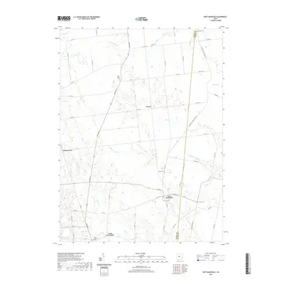
2019 Map of West Mansfield
USGS Topo · Published 2019About this map
West Mansfield serves as the primary hub of this agricultural landscape in Logan County, situated at the junction of W Center St and E Center St. The map reveals a dense network of early rural burial sites that offer significant value for genealogical research, including Quaker Cem, Early Cem, and Southard Cem. Small clusters of homes and former community centers are visible at Horton, Walnut Grove, and North Greenfield, reflecting the distributed settlement patterns of the region. The drainage system is defined by the headwaters of Bokes Cr and its tributaries, such as Middle Br Bokes Cr, which cut through the farm plots. These watercourses and the grid of township and county roads, such as CO Hwy 117 and Hamilton St, delineate the land use across the Logan and Union County border.
Find a feature on this map
61 named features on this map. Tap any name to fly to it.
Don’t see what you’re looking for? This feature index may not catch every label — zoom into the map to look around manually.
Map Details
Editions of this 2019 West Mansfield Map
This is the sole edition of this map. No revisions or reprints were ever made.
Other maps of this area

1913 · East Liberty
USGS Topo · 1:62,500

1913 · Richwood
USGS Topo · 1:62,500

1915 · Richwood
USGS Topo · 1:62,500

1915 · East Liberty
USGS Topo · 1:62,500

1915 · Kenton
USGS Topo · 1:62,500

1915 · La Rue
USGS Topo · 1:62,500

1944 · East Liberty
USGS Topo · 1:62,500

1944 · Kenton
USGS Topo · 1:62,500

1944 · Richwood
USGS Topo · 1:62,500

1950 · Marion
USGS Topo · 1:250,000