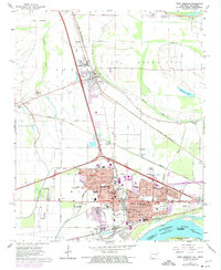
1966 Map of West Memphis
USGS Topo · Published 1974About this map
West Memphis and the neighboring county seat of Marion define this riverside landscape in eastern Arkansas during a period of significant urban growth. The map illustrates the complex drainage and transportation networks that shaped the region, including the Tenmile Bayou and Fifteenmile Bayou winding through the alluvial terrain. Major infrastructure such as the West Memphis Airport and the convergence of the Missouri Pacific and St Louis San Francisco railroads highlight the area's importance as a logistics hub.
Find a feature on this map
58 named features on this map. Tap any name to fly to it.
Don’t see what you’re looking for? This feature index may not catch every label — zoom into the map to look around manually.
Map Details
Editions of this 1966 West Memphis Map
3 editions found
Other maps of this area

1916 · Memphis
USGS Topo · 1:62,500

1925 · Memphis
USGS Topo · 1:48,000

1927 · Memphis
USGS Topo · 1:62,500

1931 · Jericho
USGS Topo · 1:62,500

1939 · Jericho
USGS Topo · 1:62,500

1939 · Edmondson
USGS Topo · 1:62,500

1939 · Memphis
USGS Topo · 1:62,500

1940 · Deckerville
USGS Topo · 1:62,500

1952 · Jericho
USGS Topo · 1:62,500

1953 · Memphis
USGS Topo · 1:250,000