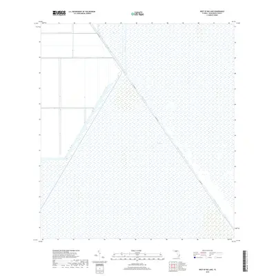
2018 Map of West of Big Lake
USGS Topo · Published 2018About this map
The Everglades define the landscape of this 2018 survey, reflecting the hydrological management of south Florida. The territory is dominated by the diagonal path of the Hillsboro Canal, a major piece of drainage infrastructure that historically shaped land use in Palm Beach County. Paralleling this waterway, Co Hwy 827 provides a primary transit corridor through the wetlands and agricultural tracts. The map illustrates a highly engineered environment where smaller works like the B-7 Canal intersect the broader marshes. This sheet captures a sparsely populated region where human activity is focused almost entirely on water control and the maintenance of the arterial roadway through the marshy terrain.
Find a feature on this map
4 named features on this map. Tap any name to fly to it.
Don’t see what you’re looking for? This feature index may not catch every label — zoom into the map to look around manually.
Map Details
Editions of this 2018 West of Big Lake Map
This is the sole edition of this map. No revisions or reprints were ever made.
Other maps of this area

1956 · West Palm Beach
USGS Topo · 1:250,000

1957 · West Palm Beach
USGS Topo · 1:250,000

1958 · West Palm Beach
USGS Topo · 1:250,000

1963 · Fort Lauderdale 2 SE
USGS Topo · 1:24,000
1970 · Loxahatchee SE
USGS Topo · 1:24,000

1970 · Loxahatchee SW
USGS Topo · 1:24,000

1970 · Shawano
USGS Topo · 1:24,000

1973 · Fort Lauderdale 2 NE
USGS Topo · 1:24,000

1973 · Fort Lauderdale 2 SW
USGS Topo · 1:24,000

1974 · Everglades 1 SE
USGS Topo · 1:24,000