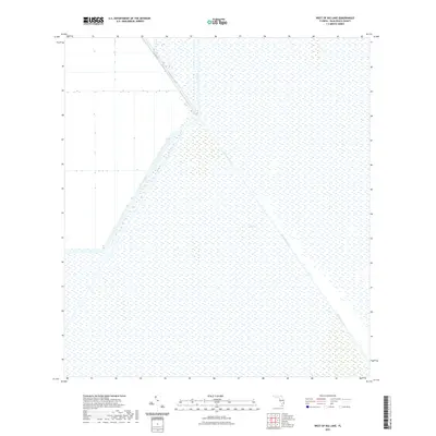
2021 Map of West of Big Lake
USGS Topo · Published 2021About this map
The Everglades dominate this landscape, illustrating the vast marshland and water management infrastructure of western Palm Beach County in the early 2020s. The area is characterized by a precise geometric grid of drainage and irrigation, essential to the agricultural operations that border the natural wetlands. The Hillsboro Canal serves as the primary hydrological artery, cutting a sharp diagonal across the sheet. It is joined by the L-7 Canal, forming a critical junction for water control. Transport is limited to the perimeter and levee roads, most notably Co HWY 827, which follows the canal's path. This map provides a clear view of the modern engineered environment where the remaining wilderness meets large-scale water diversion projects.
Find a feature on this map
5 named features on this map. Tap any name to fly to it.
Don’t see what you’re looking for? This feature index may not catch every label — zoom into the map to look around manually.
Map Details
Editions of this 2021 West of Big Lake Map
This is the sole edition of this map. No revisions or reprints were ever made.
Other maps of this area

1956 · West Palm Beach
USGS Topo · 1:250,000

1957 · West Palm Beach
USGS Topo · 1:250,000

1958 · West Palm Beach
USGS Topo · 1:250,000

1963 · Fort Lauderdale 2 SE
USGS Topo · 1:24,000
1970 · Loxahatchee SE
USGS Topo · 1:24,000

1970 · Loxahatchee SW
USGS Topo · 1:24,000

1970 · Shawano
USGS Topo · 1:24,000
1973 · Fort Lauderdale 2 NE
USGS Topo · 1:24,000

1973 · Fort Lauderdale 2 SW
USGS Topo · 1:24,000

1974 · Everglades 1 SE
USGS Topo · 1:24,000