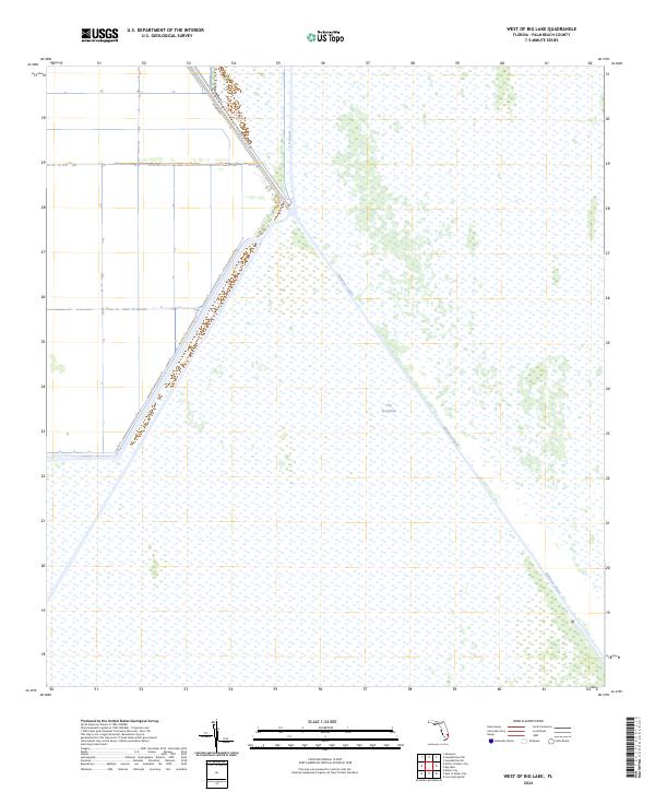
2024 Map of West of Big Lake
USGS Topo · Published 2024About this map
Arthur R Marshall Loxahatchee National Wildlife Refuge dominates the eastern expanse of this South Florida landscape, where the managed waters of The Everglades meet human engineering. The map reveals the critical infrastructure of the Central and Southern Florida Flood Control Project, most notably the diagonal course of the Hillsboro Canal and the perpendicular reach of the L-7 Canal. These waterways represent the mid-century effort to balance agricultural drainage with conservation. On the western side of the levees, agricultural development is marked by the presence of Co HWY 827, showing the sharp contrast between the northern reaches of the Everglades and the industrial farming lands of Palm Beach County.
Find a feature on this map
5 named features on this map. Tap any name to fly to it.
Don’t see what you’re looking for? This feature index may not catch every label — zoom into the map to look around manually.
Map Details
Editions of this 2024 West of Big Lake Map
This is the sole edition of this map. No revisions or reprints were ever made.
Other maps of this area

1956 · West Palm Beach
USGS Topo · 1:250,000

1957 · West Palm Beach
USGS Topo · 1:250,000

1958 · West Palm Beach
USGS Topo · 1:250,000

1963 · Fort Lauderdale 2 SE
USGS Topo · 1:24,000
1970 · Loxahatchee SE
USGS Topo · 1:24,000

1970 · Loxahatchee SW
USGS Topo · 1:24,000

1970 · Shawano
USGS Topo · 1:24,000
1973 · Fort Lauderdale 2 NE
USGS Topo · 1:24,000

1973 · Fort Lauderdale 2 SW
USGS Topo · 1:24,000

1974 · Everglades 1 SE
USGS Topo · 1:24,000