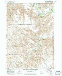
1951 Map of West Of Westover
USGS Topo · Published 1994About this map
White River meanders across the northern portion of this landscape, carving through a dramatic river valley that defines the local geography. Mapped as part of the Department of the Interior program for the development of the Missouri River Basin, this survey captures the rural character of the border between Mellette Co and Jones Co. The rugged terrain transitions from the high ground of Mullen down into the expansive Cottonwood Valley, where drainage systems like Cottonwood Creek and Butch Creek feed the larger river system. A single rural educational landmark, the Valley View Sch, sits on the southern side of the river, serving as a primary point of reference for the sparsely settled ranching or farming families of the mid-twentieth century.
Find a feature on this map
7 named features on this map. Tap any name to fly to it.
Don’t see what you’re looking for? This feature index may not catch every label — zoom into the map to look around manually.
Map Details
Editions of this 1951 West Of Westover Map
3 editions found
Other maps of this area

1951 · Okaton SW
USGS Topo · 1:24,000

1951 · Westover
USGS Topo · 1:24,000

1951 · Murdo SW
USGS Topo · 1:24,000

1951 · Murdo 3 NW
USGS Topo · 1:24,000

1951 · Murdo 3 NE
USGS Topo · 1:24,000

1951 · Okaton SE
USGS Topo · 1:24,000

1955 · Martin
USGS Topo · 1:250,000

1958 · Martin
USGS Topo · 1:250,000
1982 · Murdo 3 NW
USGS Topo · 1:25,000

1982 · White River East
USGS Topo · 1:24,000