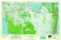
1958 Map of West Palm Beach
USGS Topo · Published 1958About this map
Lake Okeechobee dominates this mid-century landscape, acting as the heart of a massive water management network that includes the West Palm Beach Canal, Hillsboro Canal, and Miami Canal. On the southeastern shore, agricultural and labor infrastructures like the Sugar plant and Everglades Labor Center illustrate the region's industrial focus during this era. The map tracks the transformation of The Everglades as the coastal corridor from West Palm Beach down to Fort Lauderdale and Hollywood experiences significant urban development.
Find a feature on this map
149 named features on this map. Tap any name to fly to it.
Don’t see what you’re looking for? This feature index may not catch every label — zoom into the map to look around manually.
Map Details
Editions of this 1958 West Palm Beach Map
2 editions found

Other maps of this area

1945 · Fort Lauderdale North
USGS Topo · 1:24,000

1945 · Delta
USGS Topo · 1:24,000

1945 · Greenacres City
USGS Topo · 1:24,000

1945 · Lake Worth
USGS Topo · 1:24,000

1946 · Riviera Beach
USGS Topo · 1:24,000

1946 · West Dixie Bend
USGS Topo · 1:24,000

1946 · Boca Raton
USGS Topo · 1:24,000

1946 · Palm Beach Farms
USGS Topo · 1:24,000

1946 · Palm Beach
USGS Topo · 1:24,000

1947 · North Miami
USGS Topo · 1:24,000