
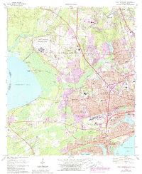
1970 Map of West Pensacola
USGS Topo · Published 1972About this map
U S Navy Air Base Saufley Field dominates the northwest quadrant of this coastal landscape, situated among the drainage basins of Elevenmile Creek and Eightmile Creek. The 1970 landscape reveals a transition from the marshy edges of Perdido Bay and Youngs Hammock to the dense residential grids of Myrtle Grove, Brownsville, and West Pensacola. Industrial activity is evident in the numerous claypits and sandpits dotting the northern reaches near Bellview.
Find a feature on this map
149 named features on this map. Tap any name to fly to it.
Don’t see what you’re looking for? This feature index may not catch every label — zoom into the map to look around manually.
Map Details
Editions of this 1970 West Pensacola Map
2 editions found
Other maps of this area

1920 · Milton
USGS Topo · 1:62,500

1921 · Pensacola
USGS Topo · 1:62,500

1921 · Fort Barrancas
USGS Topo · 1:62,500

1921 · Muscogee
USGS Topo · 1:62,500

1941 · Fort Barrancas
USGS Topo · 1:62,500

1941 · Muscogee
USGS Topo · 1:62,500

1941 · Pensacola
USGS Topo · 1:62,500

1941 · Milton
USGS Topo · 1:62,500

1942 · Pensacola
USGS Topo · 1:62,500

1943 · Muscogee
USGS Topo · 1:62,500